


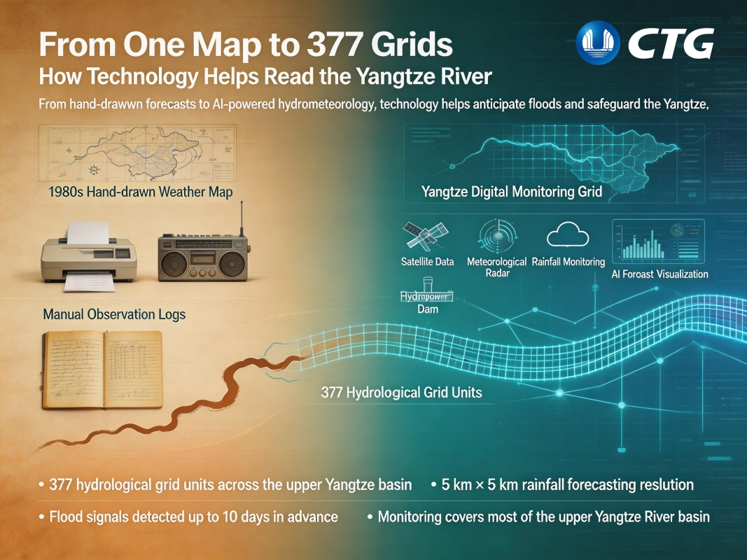
From one map to 377 grids: How technology helps read the Yangtze River
Date: 2026-03-23
From one map to 377 grids — this is how forecasting along the Yangtze River has evolved.
Today, rainfall is tracked at a 5 km × 5 km resolution, with flood signals able to be identified up to 10 days in advance.
Behind these numbers is a shift from experience-based judgment to data-driven systems, helping to anticipate floods earlier and keep the river in balance.
All Copyrigh
By China Three Gorges Corporation
Reprinting or mirroring is strictly prohibited without written authorization,
and offenders will be held liable.